


Where vehicular traffic is allowed on a street, traffic and parking regulatory signs are often placed near the sides. Bordering the driving/parking sides of many urban streets, there are curbs. Usually, there are strips of land beyond the driving/parking parts of the streets owned by the government entity owning the streets. Sidewalks are often located on these public land strips beyond the curbs on one or usually both sides of the street. There may be an unpaved strip of land between the vehicle-drivable part of the street and the sidewalk on either side of the street, which can be called the parkway or tree lawn. Grass and trees are often grown there for landscaping the sides of the street. Alternatively, there may be openings in wider sidewalks in which trees grow. Streets are often lighted at night with streetlights, which are typically located far overhead on tall poles. Beyond these public strips of land are bordered the front of lots commonly owned by private parties.
Practically all public streets are given a name or at least a number to identify them and any addresses located along the streets. Alleys typically do not have names. The length of a lot of land along a street is referred to as the frontage of the lot.
Identity
Streets assume the role of a town square for its regulars. The interaction among the people who live and work on a particular streetЧУeyes on the streetФ--can reduce crime, encourage the exchange of ideas, and generally make the world a better place.
Much as a string in a jar can precipitate a beautiful, delicate crystal, a street can serve as the catalyst for neighborhood culture and solidarity. New OrleansТ Bourbon Street is famous not only for its active nightlife but also for its role as the center of the cityТs French Quarter. Similarly, the Bowery in New York City was once known as the center of the nationТs underground punk scene. Other streets have marked divisions between neighborhoods of a city. For example, Yonge Street divides Toronto into east and west sides, and East Capitol Street divides Washington, D.C. into north and south.
Streets also tend to aggregate establishments of similar nature and character. East 9th Street in Manhattan, for example, offers a cluster of Japanese restaurants, clothing stores, and cultural venues. This phenomenon is the subject of urban location theory in economics.
A road, like a street, is often paved and used for travel. However, a street is characterized by the degree and quality of street life it facilitates, whereas a road serves primarily as a through passage for road vehicles or (less frequently) pedestrians. Street performers, beggars, patrons of sidewalk cafés, people-watchers, and a diversity of other characters are habitual users of a street; the same people would not typically be found on a road.
In rural and suburban environments where street life is rare, the terms УstreetФ and УroadФ are frequently considered interchangeable. Still, even here, what is called a УstreetФ is usually a smaller thoroughfare, such as a road within a housing development feeding directly into individual driveways.
|
|
|
If a road connects places, then a street connects people. One may Уhit the roadФ to see the wonders of the worldЧJack Kerouac famously chronicled one such journeyЧbut the latest bling will Уhit the streetsФ before it ever appears on a road. It is Уon the streetФ where one hears an interesting rumor, where one bumps into an old acquaintance, where one acquires smarts. Nobody has ever seen a УroadФ vendor or a УroadФ performer, and youТll never find yourself on a long УstreetФ to nowhere. The street, not the road, is home to the homeless, and even KerouacТs hero finally returned to find his friends on a New York street.
A town square is a little more like a street, but a town square is rarely paved with asphalt and may not make any concessions for through traffic at all.
Nomenclature

Abbey Road, London
There is a haphazard relationship, at best, between a thoroughfareТs function and its name. For example, LondonТs Abbey Road serves all the vital functions of a street, despite its name, and locals are more apt to refer to the УstreetФ outside than the УroadФ. A desolate road in rural Montana, on the other hand, may bear a sign proclaiming it УDavidson StreetФ, but this does not make it a УstreetФ.
In the United Kingdom many towns will refer to their main thoroughfare as the High Street (in the United States it would be called the Main Street -- however, occasionally УMain StreetФ in a city or town is a street other than the de facto main thoroughfare), and many of the ways leading off it will be named УRoadФ despite the urban setting. Thus the townТs so-called УRoadsФ will actually be more streetlike than a road.
Streets have existed for as long as humans have lived in permanent settlements. However, modern civilization in much of the New World developed around transportation provided by motor vehicles. In some parts of the English-speaking world, such as North America, many think of the street as a thoroughfare for vehicular traffic first and foremost. In this view, pedestrian traffic is incidental to the streetТs purpose; a street consists of a thoroughfare running through the middle (in essence, a road), and may or may not have sidewalks along the sides.
In an even narrower sense, some may think of a street as only the vehicle-driven and parking part of the thoroughfare. Thus, sidewalks and tree lawns would not be thought of as part of the street. A mother may tell her toddlers УDonТt go out into the street, so you donТt get hit by a car.Ф
Among urban residents of the English-speaking world, the word appears to carry its original connotations (i.e. the facilitation of vehicular traffic as an incidental benefit). For instance, a New York Times writer lets casually slip the observation that automobile-laden Houston Street is Уa street that can hardly be called 'street' anymore, transformed years ago into an eight-lane raceway that alternately resembles a Nascar event and a parking lot.Ф Published in the paper's Metro section, the article evidently presumes an audience with an innate grasp of the full urban role of the street. To the readers of the Metro section, vehicular traffic does not reinforce, but rather detracts from, the essential Уstreet-nessФ of a street.
|
|
|
At least one map has been made to illustrate the geography of naming conventions for thoroughfares; street, avenue, boulevard, circle, and other suffixes are contrasted against one another.
Unit 15 Trail

A country trail. A mountain trail.
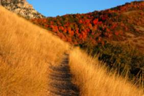
A trail is a pedestrian path or road mainly used for walking, but often also for cycling, cross-country skiing or other activities. Some trails are off-limits to everyone other than hikers, and few trails allow motorized vehicles.
In the United States, the word footpath is also used to mean a trail; however in Australian English, this word means УsidewalkФ (American English) or УpavementФ (British English).
Walking Trails

The Sendero de los quetzales in Panamá
Trail use has become very popular for a wide variety of users. Some trails are designated as nature trails, and are used by people learning about the natural world. Many trails are designated day trails, meaning that they are generally used by people out for a short hike, less than a day. Some trails are designated backpacking trails, or long-distance trails, and are used by both day hikers and by backpackers. Some of the trails are over a thousand miles (1,500 km) long and may be hiked in sections by backpackers, or completed in one trip by dedicated hikers. Some trails are specifically used by other outdoor enthusiasts to gain access to another feature, such as good climbing sites. Many runners also favor running on trails rather than pavement, as giving a more vigorous work-out and better developing agility skills, as well as providing a more pleasant exercise environment.
Bicycle Trails
Recent decades have seen an explosion of interest in cycling, both street-type and off-road type. Many graded, surfaced bike paths have been built, but especially popular is the off-road, or mountain biking. A common term for these facilities is simply Уbike trailФ. These trails may be built to a different set of standards than foot trails, requiring more stable, harder surfaces, less strenuous grades, longer sight visibility, and less sharp changes in direction. On the other hand, the cross-slope of a bike trail may be significantly greater than a foot trail, and the actual treadway may be narrower in some cases.
A particular offshoot of trail biking is downhilling, which can be environmentally destructive if not well-managed. Downhilling is particularly popular at ski resorts such as Mammoth Mountain in California or Whistler in British Columbia, where ski lifts are used to get bikes and riders to the top of the mountain.
Because of the greater need for more gradual grades, changing elevations may involve sidehill trails with multiple switchbacks, while these may not be necessary for hikers. In cases where hikers use these bike trails, attention must be paid to the potential of cutting across switchbacks.
Where bike trails intersect with pedestrian or equestrian trails, signage at the intersections is important, and high visibility onto the intersecting trails must be a priority in order to prevent collisions between fast-moving cyclists and slower moving hikers and horses. Bicycles and horses should be allowed on the same trails where the trail is wide enough with good visibility.
A well designed bike trail will have an average grade of less than 10%, and will generally follow a countour line, rather than straight downhill. The trail should slope out or accross the trail 3-5% downhill to encourage water to run off the side, rather than down the trail bed. In addition, frequent grade reversals also prevent water from running down the trail, make the trail more fun and interesting to ride, and generally help keep bike speeds down, providing a more safe trail experience for all users.
Equestrian Trails
Horseback riding has continued to be a popular activity for many trail users. Again, horse trails must be built to different standards than other trails. Sight distance is an important issue with horse trails, as is overhead and side clearance. While trail surface types are a relatively insignificant issue with hikers, they may be an important issue with horses. Horses can negotiate much steeper terrain on a dirt trail, for instance, than on a gravel trail. Horses can usually negotiate much the same grades as hikers, but not always, although they can more easily clear obstacles in the path such as logs. A hard trail surface and drainage is a critically important issue on horse trails because of the relatively greater bearing impact of the horseТs hoof on the trail than a hikerТs foot.
|
|
|
Trail Construction

A walking path.
While many trails have arisen through common usage, quality trail design and construction is a complex process requiring certain sets of skills.
When a trail passes across a flat area that is not wet, often all that is required is to clear brush, tree limbs and undergrowth to produce a clear, walkable trail. When crossing streams, bridges may or may not be desirable, depending on the size of the stream and the depth of its banks. In wet areas, it may be necessary to create an elevated trailway with fill or by building a boardwalk. One problem with boardwalks is that they require frequent maintenance and replacement - boards in poor condition are often slippery and hazardous.
Trails on Slopes

This trail leads straight over the hill.
A common mistake in establishing trails is to make them on slopes that are too steep for comfort and the environment. Such steep trails generally result in serious erosion, a wide swath of impacted area as walkers go to the sides to find better footing, and the inability of many hikers to walk the trail. An absolute limit for trail grades is a grade of one in six, and a more practical limit is a slope of one in eight. Trails that ascend steep slopes may use switchbacks (also called hairpins), but switchback design and construction is a specialized topic that takes great care. The best trail designs eliminate switchbacks.
If a trail is being made to be accessible to off-road wheelchairs, the grade should be no more than one in ten. If a paved trail has to be accessible to all wheelchairs, the grade must be no more than one in twelve, with periodic level pull-offs.
The off-slope, or side-slope, of the trail also must be considered. This is the slope of the trail from side to side, and should never be more than one in twelve. Side-sloped trails are prone to gullying. Ideally, the treadway of the trail should be almost, but not quite, level in cross-section.
Achieving the proper slope in hilly terrain usually requires the excavation of sidehill trail. This is trailway that is constructed by establishing a line of suitable slope across a hillside, then digging out by means of a mattock or similar tool to create the trail. This may be a full-bench trail, where the treadway is only on the firm ground surface after the overlying soil is removed and thrown to the side as waste, or a half-bench trail, where soil is removed and packed to the side so that the treadway is half on firm old ground and half on new packed fill. In problem areas, it may be necessary to establish the trail entirely on fill. In cases where filling is used, itТs necessary to pack it firmly and to revisit the site periodically to add to the fill and repack it until fully stable.
Drainage
An important and often-overlooked factor in trail construction is that of drainage. Where a trail is near the top of a hill or ridge, this is usually a minor issue, but when it is farther down it can become a very major issue. Trails, by their nature, tend to become drainage channels and eventually gullies if the drainage is not properly controlled.
|
|
|

A waterbar in New YorkТs Catskill Mountains. The trail forks right; the drainage ditch to the left.
In areas of heavy water flow along a trail, it may be necessary to create a ditch on the uphill side of the trail with drainage points across the trail. The cross-drainage may be accomplished by means of culverts, which must be cleared on a semi-annual basis, or by means of cross-channels, often created by placing logs or timbers across the trail in a downhill direction, called waterbars. Using timbers or rocks for this purpose also creates erosion barriers. Rock paving in the bottom of these channels and in the trailside ditches may help to maintain stability of these. Ideally, waterbars should be created, with or without ditching, at major points of water flow on or along the trail, and in conjunction, if possible, with existing drainage channels below the trail. Another important technique is to create drain dips, points on the trail where it falls briefly (for a metre or so) and then rises again. These provide positive drainage points that are almost never clogged by debris.
Multi-use Trails
Trails intended for use by bicycles, wheelchairs and pedestrians will often be surfaced, especially in heavily-used or urban areas. This can be asphalt paving, or compressed stone dust. Such trails will also have well-built bridges with a supported deck and side rails.
There has been a major effort to convert abandoned railroad grades to bike paths or multi-use paths.
Signs

The most common symbols used in trail blazing
For long-distance trails, or trails where there is any possibility of anyone taking a wrong turn, signs should be provided. This may be accomplished by using either paint on natural surfaces or by placing pre-made medallions. Horseshoe-shaped blazes are good for equestrian trails (but be sure to have the УuФ of the horseshoe opening to the top, or youТll offend some riders!). The Appalachian Trail is blazed with white rectangles. Blue is often used for side trails. European walking paths are blazed with yellow points encircled with red. However, other walking paths in European countries are blazed in a variety of manners.
Maintenance
Natural surface, single track trails will require some ongoing maintenance. However, if the trail is properly designed and constructed, maintenance should be limited to clearing downed trees and trimming back brush. If the trail is properly designed, there should be no need for major rework such as grading or erosion control efforts.
Unit 16 Ancient Trackway
Ancient trackway can refer to any track or trail whose origin is lost in antiquity. Such paths existed from the earliest times and in every part of the globe. The term is commonly used on the British Isles to describe the ancient trackways that already existed when the Romans arrived in Britain. Such trackways were often built on by the Romans and form the foundations of some of the current system of roads.
The Beginnings
The Concise Oxford Dictionary gives the definition of УtrackwayФ as Уa path formed by the repeated treading of people or animalsФ. The very earliest creatures to arrive in Britain after the Ice Age, crossing land which would later be the English Channel, were grazing animals following the spreading vegetation. Their predators, including humans Ц the Mesolithic (Middle Stone Age) hunter-gatherers - followed. The earlier Mesolithic people were nomadic but in the later part of the Mesolithic permanent settlements started to appear.
The Trackways
These settlements were connected with each other by the ancient trackways. These green ways often followed natural contours in the landscape, and had evolved over time as animals were driven from place to place, and pedestrians walked to and from neighbouring settlements. Much of the land was forested; the lower valleys provided fertile land and were ideal places for fishing, agriculture and the rearing of cattle.
The trackways will have provided links in many ways: farmsteads to fields; to other farmsteads; to the neighbouring long barrow tomb; with long-distance trackways joining the separate localities to the camp meeting places and cross-country flint roads. Others were more likely to have been processional ways, like one heading for the gigantic temple at Avebury. Others, the long-distance ways mentioned above, are now known as the Icknield Way, the Ridgeway National Trail, the Harrow Way and the PilgrimsТ Way.
|
|
|
Some of these trackways followed the tops of higher land, while others progressed along the lower slopes. The lowland areas were thickly forested and poorly drained and for long distance travel there was an advantage in following the top of a line of hills. Skills to develop tracks across bog lands, such as in Somerset, were learnt by early people. Known as corduroy roads, they were formed when huge quantities of alder poles and brushwood were used to link the fen islands across the marshes. The Sweet track in the Glastonbury fens, Somerset is the oldest purpose built road in the world and has been dated to the 3800s BC.
Settlements
On occasion, where rivers caused an obstacle to progress, bridges were built across them, and several roads met to use the bridge. Here major settlements grew, providing sustenance to travellers and their animals using the trackways. There are many good example of this: three follow.
Wallingford
The original settlement at Wallingford in Oxfordshire dates back to the dawn of British history, when its founders showed a remarkable amount of discrimination in choosing its site. Nestling in a fertile valley on the banks of the River Thames, it was an ideal place for fishing, agriculture and the rearing of cattle. The ancient trackways, in particular the Icknield Way, gave it lines of communication converging on its ford. The remains of the ramparts, which still surround the town, are the successors of the rudimentary fortifications of the old British settlement, were adapted in turn by Roman, Saxon and Norman conquerors.
Brownhills
A similar site is Brownhills once in Staffordshire, now in West Midlands. Brownhills was a meeting point for ancient roads and trackways since prehistoric times. It is thought that the Watling Street was in use before the Romans came, and what were later called the Chester Road and Coventry Road are also thought to have been ancient trackways.

